


Trail navigation is a vital skill for anyone venturing into the wilderness, whether you’re hiking, backpacking, or trekking. It’s more than just reading a map or following a trail. It’s about understanding how to orient yourself in the natural world, avoid getting lost, and ensure a safe and enjoyable journey. This skill set involves a combination of knowledge, practice, and gear, and can mean the difference between a successful adventure and a potentially dangerous situation. So, let’s dive into the key aspects of trail navigation, from the basics to more advanced techniques.
1. The Foundation: Understanding the Basics
Before you hit the trail, it’s important to know the fundamental concepts of navigation. At the core of trail navigation are the following tools and techniques:
Maps
A good trail map is your best friend. But not just any map—an outdoor map. Topographic maps are particularly useful because they provide detailed terrain features, showing elevation changes, rivers, ridges, and valleys. Unlike street maps, topographic maps use contour lines to represent changes in elevation, which can help you predict the difficulty of your route and understand the landscape around you.
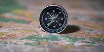
Compass
While a GPS is a modern convenience, a compass remains an indispensable tool for navigating in the wild. A compass is simple, reliable, and doesn’t depend on batteries. Learning how to use a compass in conjunction with a map will allow you to orient yourself in any direction.
- Basic Components of a Compass: The key parts include the needle, the dial, the bezel, and the base plate. The needle always points to magnetic north, which allows you to find your bearings.
- Using a Compass with a Map: This is called “taking a bearing” and involves aligning the compass with the map to figure out which direction you need to travel to reach your destination.
Land Navigation Skills
Even though modern technologies like GPS apps make navigation easier, understanding the basics of land navigation is crucial. Using landmarks, natural features like rivers, mountain peaks, and valleys, or even the direction of the sun, can help orient you when you lose your way or technology fails.
2. Advanced Navigation Techniques
Once you’re familiar with the basic tools, you can start exploring advanced techniques that will help you stay safe and confident on the trail.
Taking Bearings
A bearing is the direction to travel from your current position to a specific point on the map. You take a bearing with a compass, and then use it to walk in a straight line toward your destination.
- How to Take a Bearing: Point the compass toward the object you want to reach. Rotate the compass dial so the orienting arrow lines up with the magnetic needle. The number that lines up with the index line on the compass is your bearing.
- Following the Bearing: After setting your bearing, you can walk in the direction of the needle, constantly adjusting for magnetic declination and obstacles in your path.

Magnetic Declination
The Earth’s magnetic field doesn’t align perfectly with true north. Depending on where you are, the difference between magnetic north (which your compass points to) and true north (which is used on most maps) is called magnetic declination.
You need to adjust for this discrepancy to ensure accurate navigation. In some regions, this might be a few degrees, while in others it could be 20 degrees or more. Many maps provide the declination for the area, and a good compass will allow you to adjust the dial accordingly.
Pacing and Dead Reckoning
Sometimes, when visibility is poor or you’re traveling through dense forests or unfamiliar terrain, you may need to navigate using “dead reckoning.” This means relying on your known position, taking a bearing, and counting your steps to estimate distance.
- Pacing: One way to track how far you’ve traveled is by counting your steps, or pacing. Each person’s stride length is different, but by knowing how many steps it takes you to travel a specific distance, you can estimate how far you’ve gone.
- Dead Reckoning: If you take a bearing and then walk for a set number of steps (or a set amount of time), you can estimate where you’ll be. This technique helps when you can’t see landmarks, and the trail is not clearly marked.
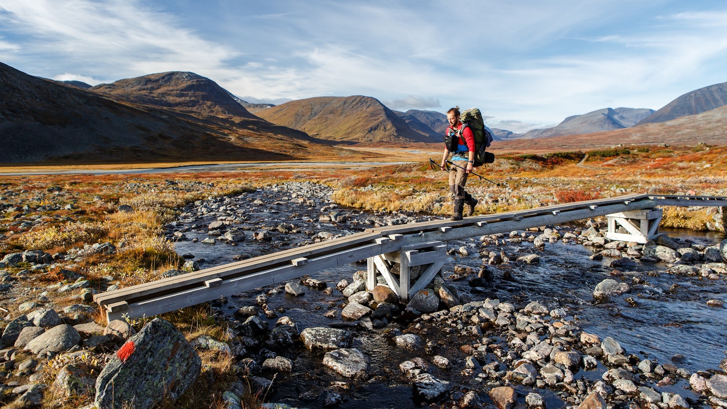
3. Navigating in Different Environments
Every terrain presents its own unique set of challenges. Understanding how to adapt your navigation skills to different environments will make you a more versatile navigator.
Forest Navigation
In forests or dense woodlands, it can be difficult to see far enough ahead to orient yourself. Trails may not be marked clearly, and you could be surrounded by similar-looking trees and features. To improve your navigation:
- Use the Sun: The sun rises in the east and sets in the west, so use it as a reference point. In the morning, the sun will be in the eastern part of the sky, and in the afternoon, it will be in the west.
- Follow Water Sources: Rivers, streams, and lakes can act as natural guides. If you’re following a river, make sure you understand its direction of flow and how it connects to other landmarks or trails.
Mountain Navigation
In mountainous terrain, elevation changes play a huge role in navigation. The landscape may be jagged with few landmarks, but you can use ridgelines, peaks, and valleys to orient yourself.
- Contours on a Map: Topographic maps show contours that reveal changes in elevation. When navigating in the mountains, use these contours to understand how steep or gradual the terrain might be. Steep climbs will have tightly spaced contour lines, while gradual slopes will have wide gaps.
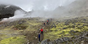
- Plan for Weather: Weather conditions can change rapidly in the mountains. Strong winds, snow, and low visibility can make navigation more challenging. Always carry the proper gear and be prepared to take shelter if necessary.
Desert Navigation
The desert might seem straightforward, but it’s easy to become disoriented in the barren landscape. Here, the lack of landmarks and the extreme heat can be dangerous.
- Landmarks: Look for any unique rock formations, cacti, or other features that can help guide you.
- Navigation by Stars: At night, when the sun is gone, the stars can be your guide. In the Northern Hemisphere, the North Star (Polaris) indicates true north, and learning to navigate by the stars can be a lifesaver.
4. The Role of Technology in Navigation
While traditional methods are essential, technology has revolutionized navigation, making it easier and more efficient in some cases.
GPS Devices and Apps
GPS devices are invaluable for modern hikers, offering real-time location tracking and route planning. Some popular GPS devices are designed specifically for hiking and have preloaded maps of popular trails. Smartphone apps like AllTrails, Gaia GPS, or Komoot also allow you to download maps and follow tracks, providing detailed navigation information.
However, it’s important to remember that electronic devices depend on battery power and might not work in remote areas without cell service or GPS signals. Always bring a backup, like a paper map and compass, in case technology fails.
Digital Compass and Altimeter
Some advanced GPS units also include a digital compass and altimeter. The compass will help you orient yourself, while the altimeter tracks your elevation, which can be useful for determining your location when you’re on a mountain or in a large canyon.
5. Staying Safe While Navigating
Navigation is not just about finding your way—it’s about making sure you do so safely.
Planning Your Route
Proper trip planning is essential. Always study the trail or area you plan to visit before you leave. Know the route, the landmarks, potential hazards, and the estimated time it will take. Have a backup plan in case something goes wrong.
Carry Extra Gear
In addition to the basics (map, compass, water, food, first aid kit), consider carrying a whistle, flashlight, multi-tool, and fire-starting materials. These can be useful if you get lost or find yourself in an emergency situation.
Stay Calm if Lost
If you become lost, try not to panic. Stop, stay put, and assess the situation. Use your map and compass, or even landmarks, to figure out your location. Often, retracing your steps or backtracking along a known trail is the easiest way to get back on track.
Conclusion
Mastering trail navigation is an essential skill that requires both knowledge and practice. Understanding the terrain, using the right tools, and staying calm in difficult situations can help ensure a safe and enjoyable outdoor experience. Whether you’re hiking in the forest, trekking across mountains, or navigating a desert, your ability to navigate effectively will enhance your adventure and keep you safe.
As with any skill, the more you practice, the better you’ll become. So get out there, explore the trails, and enjoy the process of learning how to navigate the great outdoors!


